Source of the photo
http://www.meteoprog.ua/en/water/AllSeas/
Author of the description
GK
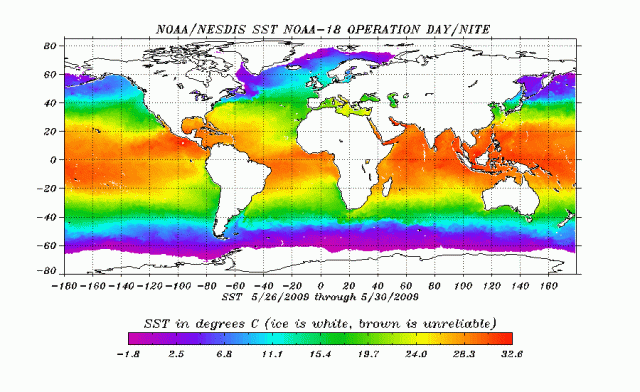
Seas and oceans surface temperature is based on satellite images data processing. The period displaying average data is 26−30 May, 2009.
The map is prepared by NOAA NESDIS, USA (National Environmental Satellite, Data, and Information Service).
Source of description
http://www.meteoprog.ua/en/water/AllSeas/
